25 days till go time: An update on our Southern Alps Traverse preparations
In 25 days, Conor, Tōrea, Maddy and I are setting out on a trip that has been over a year in planning. In a nutshell, the plan is a traverse of the New Zealand Southern Alps (Kā Tiriti o te Moana), from Arthurs Pass to deep Fiordland, over a period of 3 months. The trip will take us across glaciers, up peaks and to many of New Zealand's most remote and rarely visited locations. This post is a bit of an update on how the planning and preparation is coming along for this trip.
Route planning
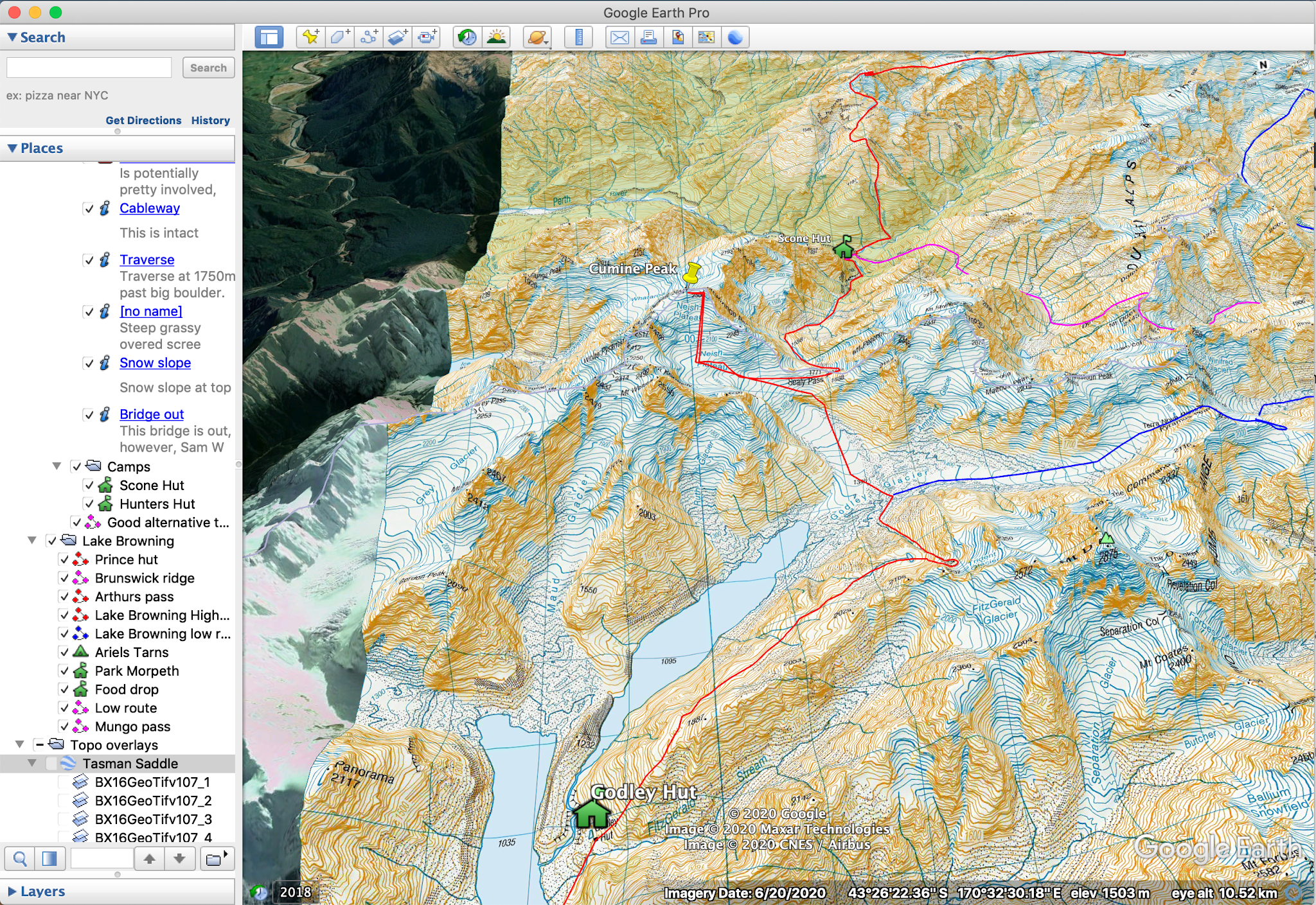
From the middle of the year, we have slowly been piecing together, a red line (or planned route) through the Southern Alps using mainly google earth. Our route aims to stay as closely as possible to the spine of the main divide, taking us through some incredible tops. A summer of perfect weather will take us through incredible places such as Ivory Lake, Bracken Snowfields, the Gardens, West Coast Neves, the Lower Balfour and the Copland, the Landsborough, Dechen, the Volta, the Olivine Range and through the Darrans, with Sinbad, the Llawrenny Range, Terror Peak and Lady of the Snows to finish. What the weather allows will be a completely different story, and we look forward to the challenges that we will undoubtedly face. To construct this route we have been using a combination of guidebooks, NZTopo maps and satellite imagery. In addition to this, we have had fantastic beta from many incredible people including Rob Frost, Alastair McDowell, Rose Pearson, Lydia McLean, Geoff Spearpoint, Max Olsen, James Thornton and Nina Dickerhof to whom we are incredibly grateful.
This photo gives an insight into the red line for a particular section, including a number of alternatives.


Comments
Post a Comment