Posts
A Radline of a Redline
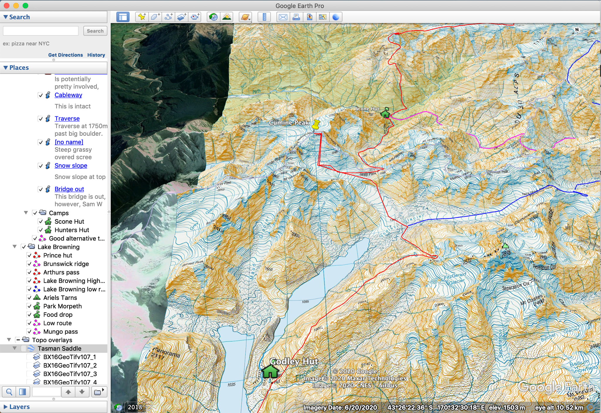
With the beginning of our traverse coming up rapidly, we're excited to have completed a route plan for the entire traverse. We have divided the route into several sections which we have been working on since April this year. The red line here is our optimal route for the traverse. However, we have also planned several wet weather options for when conditions are not ideal. The planning process also included putting together a 20 page document filled with route descriptions, photos and detailed beta for reference. Use the map below to have a look at our route! View Larger Topographic Map
Bearing beans up the Beansburn

It begins! After a long day of vac sealing and measuring cups of oats, we finally get to do the most fun job. Dropping the food off! We leave Dunedin at 4am with minimal faff, all making pleasantly surprised comments about how little actual gear you need to pack for a trip like this. The drive is enjoyable, with large moon, drive through misty Otago, and eventual sunrise. Lucky Tom is a good early morning driver. Sam and I both do some sleeping, in preparation for the tasks ahead. Task 1: Aquire Buckets for rodent and weather proofing our food. A quick stop in Frankton Mitre 10 sorts us out, where the staff are really helpful and lovely and direct us to everything we need, and find us some awesome vac seal bags with inbuilt nunu valves. Task 2: Find Tom the Spencer for indispensable food carrying contributions. How will we possibly do that? We drive into Glenorchy, and see the big red van with coffin box on top parked on GY's only road. Success. Tom Spencer has written a poem for o...
25 days till go time: An update on our Southern Alps Traverse preparations
In 25 days, Conor, Tōrea, Maddy and I are setting out on a trip that has been over a year in planning. In a nutshell, the plan is a traverse of the New Zealand Southern Alps (Kā Tiriti o te Moana), from Arthurs Pass to deep Fiordland, over a period of 3 months. The trip will take us across glaciers, up peaks and to many of New Zealand's most remote and rarely visited locations. This post is a bit of an update on how the planning and preparation is coming along for this trip. Route planning From the middle of the year, we have slowly been piecing together, a red line (or planned route) through the Southern Alps using mainly google earth. Our route aims to stay as closely as possible to the spine of the main divide, taking us through some incredible tops. A summer of perfect weather will take us through incredible places such as Ivory Lake, Bracken Snowfields, the Gardens, West Coast Neves, the Lower Balfour and the Copland, the Landsborough, Dechen, the Volta, the Olivine Rang...
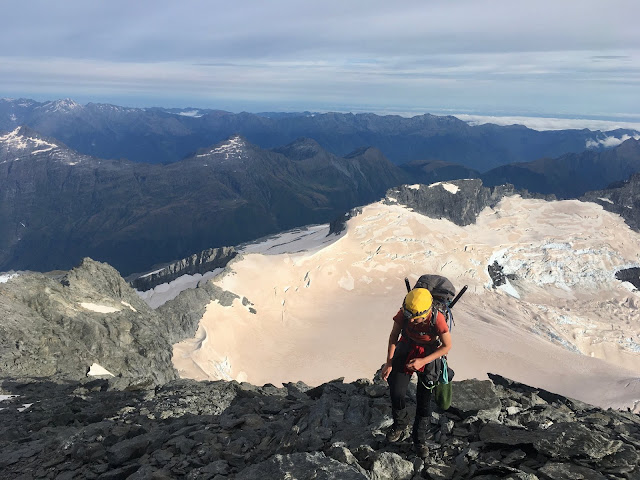
The SW Ridge of Mt Aspiring

30/6/20 - 3/7/20 Party: Owen Daniell, Alastair McDowell, Tom Hadley Author: Owen Daniell Alastair descending the NW Ridge after a successful climb of the SW ridge (Tom Hadley) “You guys keen for Southwest ridge?” We’d been hinting at it for the last day or so, but neither of us really thought it in the cards. I had known Tom Hadley and Maddy Whittaker would be in Wanaka for some time during the break, and had tactfully based myself there in hopes of an invitation. Tom and Maddy arrived back in Wanaka from a pioneer hut mission and we were soon joined by Alastair McDowell. Maddy unfortunately had to return to Dunedin for some study. Tom and I were originally thinking of Mt. Avalanche, Popes Nose or Rob Roy. The unexpected addition of Alastair’s ice leading experience opened up the Southwest ridge of Aspiring as a potential objective. The mention of such an objective sent pangs of nervousness through Tom and me. Each of us had somewhat minimal ice climbing experience, and the ...
Snowdrift Range Traverse: Tom's Version of Events

8/3/20 - 12/3/20 Party: Thomas Hadley, Maddy Whittaker, Torea Scott-Fyfe Maddy and I had “done uni” for an utterly excessive period of about 8 days and both had an itching for an epic. The plan was devised by looking at the expanses of wavy blue contours of the snowdrift range, a series of epic glaciers nestled in the inhospitable olivine wilderness. We created the route the best way possible, drawing an ambitious line on the map with lots of big question marks and hoping for the best. We planned to traverse the entire snowdrift range, a route which had a lot of unknowns for us. Particularly, a steep face of blue contours required to get over Mt Lydia's North shoulder. We knew one party had ascended it in early season conditions, but other than that, we were unsure. We set off at 6.30pm on Sunday evening up the Matukituki valley to Liverpool Hut, accompanied by Torea who planned to stay the night with us then return to Wanaka for work that week. After a few wet dark hours ...
North West Ridge of Mount Aspiring
18/2/2020 - 19/2/2020 Party: Torea Scott-Fyfe, Tom Hadley I'd just arrived back in the South Island and Torea had just finished 12 days of fieldwork when we met in Wanaka. There was 2 days of workable weather ahead of us and we were both ready to get stuck into some mountains. Tom: “Hmmm well the Raspberry flat road is open again”, Torea: “Oooh yes we could climb some domes”, Tom: “Hmmm how about climbing the big dome...?”, “Yes let’s climb Mt Aspiring!”. The next morning, we set off with light packs and lighter legs from raspberry flat at 8am, jogging and walking along the expanses of the Matukituki valley. The open grasslands soon turned to beech forest, then to scrub as we carried on. We arrived at the waterfall in 4 hours time and began the push up to Bevan col. After negotiating slabs and bluffs, the expanse of the Bonar glacier spread itself out before us. We moved our way through gurgling blue crevasses to arrive at an empty Colin Todd hut, how good! At 5am the nex...